TorontoOntario · 36 tours
 Niagara FallsOntario · 25 tours
 New York CityNew York · 30 tours
 Las VegasNevada · 8 tours
 San FranciscoCalifornia · 16 tours
 VancouverBritish Columbia · 17 tours
 DubaiUAE · 54 tours
 Abu DhabiUAE · 5 tours
 Buenos AiresArgentina · 23 tours
 AthensGreece · 31 tours
 AucklandNew Zealand · 38 tours
 CancunMexico · 54 tours
No destinations match “”. Try searching all tours instead — that search understands full questions, not just place names.
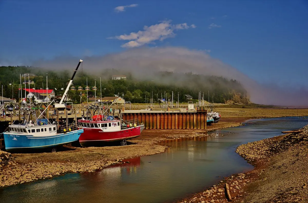
Home to the highest tides in the world, rising and falling by as much as 16 metres twice a day.
Visitor guide
The Bay of Fundy lies between New Brunswick and Nova Scotia, with a small portion touching Maine, and is known for the largest tidal ranges anywhere. Saint John, on its New Brunswick shore, is the largest population centre on the bay. The coastline here mixes working harbour, rocky headlands, mudflats and forest, all reshaped twice a day by the tide.
The bay is a long, narrowing inlet whose natural sloshing period closely matches the timing of the Atlantic tide, so each incoming tide is amplified as it is squeezed toward the upper bay. Wikipedia gives the bay's maximum length as about 151 km and maximum width about 52 km, and says tides are semidiurnal with roughly 6 hours 13 minutes between each high and low. It also reports that about 100 billion tonnes of water move in and out in each half-day cycle, roughly twice the combined flow of the world's rivers. The worldwide average tidal range, by comparison, is about 1 metre.
Figures are often quoted loosely. Wikipedia gives an average range for the bay of about 16 metres, but Guinness World Records lists Burntcoat Head in Nova Scotia's Minas Basin with a mean spring range of 14.5 metres and an extreme range of 16.3 metres, and other sources give a mean of around 11.7 metres. Parks Canada says that at Fundy National Park twice a day up to 12 metres of water or more rush in and out. At Saint John, near the mouth of the bay, ranges are smaller: a harbour marker and several sources give about 7 metres on average, and the city's tourism office cites up to 8.5 metres. The single highest recorded water level, 21.6 metres, came in October 1869 when the Saxby Gale storm surge coincided with a very high tide.
The Fundy Basin began forming about 220 million years ago in the Late Triassic as Pangaea started to break up. Basalt flows left features such as columnar jointing on Grand Manan and Brier Island, and the wider bay shore holds fossils from Joggins to Burntcoat Head. The Mi'kmaq lived around the bay for centuries before Europeans arrived; Port Royal was founded in 1605 by Pierre Dugua and Samuel de Champlain, and Acadians settled along the bay about 75 years later. In the 19th century the bay was a major shipbuilding area, a legacy still visible in Saint John's heritage buildings, and Wikipedia describes Saint John as the first incorporated city in what is now Canada.
At low tide the shoreline exposes rock shelves and mudflats that sit under many metres of water a few hours later, which is why local advice is always to check tide tables and keep clear of the water's edge on flats. The bay supports whales and seabirds, including fin, humpback and minke whales and the endangered North Atlantic right whale, though sightings depend on season and operators. Near Saint John, the Reversing Falls and Irving Nature Park are the two easiest places to see the tide at work, and Fundy National Park to the east has about 20 km of Fundy shoreline according to Parks Canada.
See every tour and attraction we cover in Saint John.