TorontoOntario · 36 tours
 Niagara FallsOntario · 25 tours
 New York CityNew York · 30 tours
 Las VegasNevada · 8 tours
 San FranciscoCalifornia · 16 tours
 VancouverBritish Columbia · 17 tours
 DubaiUAE · 54 tours
 Abu DhabiUAE · 5 tours
 Buenos AiresArgentina · 23 tours
 AthensGreece · 31 tours
 AucklandNew Zealand · 38 tours
 CancunMexico · 54 tours
No destinations match “”. Try searching all tours instead — that search understands full questions, not just place names.
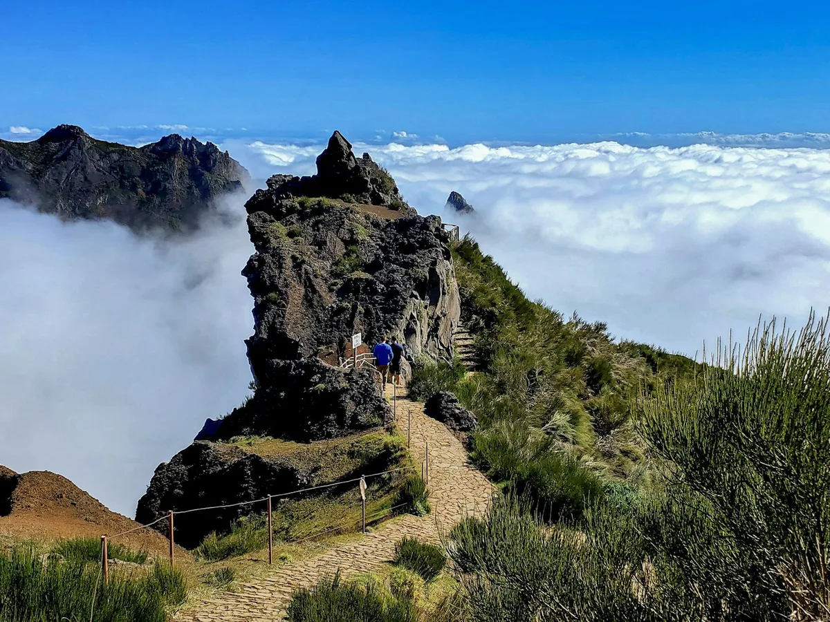
Madeira's third-highest peak (1,818m), reached by road, with a sunrise viewpoint often looking out over a sea of clouds.
Visitor guide
Pico do Arieiro, also spelled Pico do Areeiro, is a mountain summit in the interior of Madeira, Portugal, rising to 1,818 metres. Wikipedia lists it as the third highest peak on the island, and it is reachable by road from Funchal, making it one of the easiest high viewpoints to visit and the starting point of a well-known trail to Pico Ruivo.
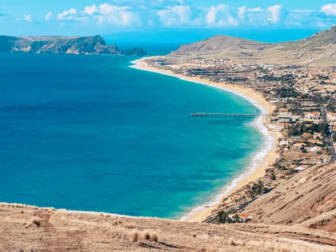
The summit lies in Madeira's mountainous interior, roughly midway between the north and south coasts. A car park, a restaurant and a souvenir shop sit near the top, and on a clear day the view extends to the island of Porto Santo, about 48 kilometres to the northeast. A Portuguese Air Force air defence radar station was built near the summit in 2011, beside the visitor facilities. Wikipedia notes that the area is busy at peak times, with up to 1,000 people a day passing through, so conditions at the viewpoint change a great deal between early morning and midday.
At this altitude the weather differs sharply from the coast. Wikipedia describes a cool Mediterranean climate that is surprisingly wet for its type, with frequent drizzle and fog. A table for a station at 1,610 metres records an annual mean daily maximum of about 12.1 degrees Celsius, a mean minimum of about 6.0 degrees and annual rainfall near 2,928 millimetres, with January the wettest month and July the driest. The coast can be warm and sunny while the summit sits in cloud, and a clear view can open or close quickly. Visitors often describe looking down on a layer of cloud from above, a view that depends on the day.
Pico do Arieiro is the traditional starting point for the high mountain walk to Pico Ruivo, the island's highest point at 1,861 metres. According to Wikipedia's article on Pico Ruivo, the PR1 route runs about 7 kilometres and takes roughly three and a half hours, connecting Pico das Torres and Pico Ruivo with volcanic tunnels, steep staircases and exposed slopes. It is rated moderately challenging, and the weather can change fast, so proper footwear and layers are advisable. The same article notes that entry arrangements apply on PR1, and conditions should be checked before going.
The high ground between Pico do Arieiro and Pico Ruivo is the nesting area of Zino's petrel, locally called the freira, one of Europe's rarest seabirds. Wikipedia says the petrels nest in burrows on inaccessible, vegetated ledges in the central mountains above about 1,650 metres. The species was rediscovered in 1969 when the ornithologist Paul Zino played a recording of a petrel call to a shepherd from Curral das Freiras, who recognised it and led researchers to the nesting area. The species is listed as Endangered and protected within the Madeira Natural Park, and a conservation project has run since 1986. Because the birds are sensitive to disturbance, visitors are asked to stay on paths.
Below the peaks, the island's laurel forest, a UNESCO World Heritage Site since 1999, covers roughly a fifth of Madeira, and the high ridges around the peak support heath and low shrubs.
The drive from Funchal climbs steadily on winding roads, and cyclists also attempt the ascent, which publications describe as among the toughest in the world, with about 1,810 metres of climbing over 22 kilometres. A private driver removes the need to manage the mountain road and parking, and a guide can advise on timing the visit around cloud and light.
See every tour and attraction we cover in Madeira.