TorontoOntario · 36 tours
 Niagara FallsOntario · 25 tours
 New York CityNew York · 30 tours
 Las VegasNevada · 8 tours
 San FranciscoCalifornia · 16 tours
 VancouverBritish Columbia · 17 tours
 DubaiUAE · 54 tours
 Abu DhabiUAE · 5 tours
 Buenos AiresArgentina · 23 tours
 AthensGreece · 31 tours
 AucklandNew Zealand · 38 tours
 CancunMexico · 54 tours
No destinations match “”. Try searching all tours instead — that search understands full questions, not just place names.
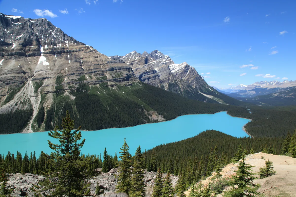
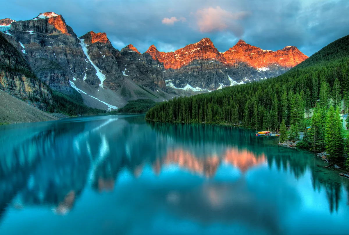
A striking turquoise lake viewed from a high overlook along the Icefields Parkway, colored by glacial rock flour from the Peyto Glacier.
Visitor guide
Peyto Lake is a glacier-fed lake in Banff National Park, sitting at about 1,860 m (6,100 ft) just off the Icefields Parkway. It lies in a valley of the Waputik Range between Caldron Peak, Peyto Peak and Mount Jimmy Simpson, and is best known for the view down onto its vivid turquoise water from the Bow Summit viewpoint.
The lake is roughly 2.8 km long and 0.8 km wide, with a surface area of about 1.4 square kilometres. Peyto Creek feeds it, draining Caldron Lake and Peyto Glacier, part of the Wapta Icefield, and the Mistaya River begins at its outflow. The colour comes from rock flour, fine rock particles ground by the glacier and carried in by meltwater. Because the glacier is close, the particles reach the lake still suspended, and the colour is typically at its brightest in mid-summer when melt is at its peak. It is dull and can be frozen early and late in the year.
The creek that feeds the lake starts at Peyto Glacier, one of the outlet glaciers of the Wapta Icefield. That icefield straddles the Continental Divide in the Waputik Mountains, is shared between Banff and Yoho national parks, and covered roughly 80 square kilometres in the 1980s. Its other main outlets are the Bow, Vulture and Yoho glaciers, and its name comes from a Stoney word meaning river. Walter Wilcox's 1896 photograph is described as the earliest record of Peyto Glacier, systematic research is said to have begun only in 1965, and an automatic weather station was installed nearby in 1987. The glacier has been shrinking: one estimate cited by Wikipedia has it losing around 1,088 million cubic metres of volume between 1896 and 1966, and a later study is reported to put its mass loss since early research at roughly 70 percent. Treat those figures as indicative, because the article itself asks for better citations. The Alpine Club of Canada's Peter and Catharine Whyte Hut, also called Peyto Hut, serves mountaineers on the glacier, but it is a destination for experienced parties rather than lake visitors.
The mountains named around the lake carry their own stories. Mount Jimmy Simpson, at 2,966 m, was first climbed in 1897 by J. Norman Collie, George Percival and Peter Sarbach, and takes its name from the outfitter Jimmy Simpson (1877-1972), who learned guiding from Bill Peyto and built the cabin at Bow Lake that grew into Num-Ti-Jah Lodge. The mountain is formed of sedimentary rock laid down in shallow seas and thrust eastward during the Laramide mountain-building episode. Peyto Peak, at about 2,970 m, was first climbed in 1933. The Waputik Mountains as a whole were named by geologist George Dawson in 1884 from a Stoney word for white goat.
The lake and glacier are named for Bill Peyto, an early Banff-area guide, trapper and park warden. Wikipedia gives his full name as Ebenezer William Peyto and says he was born in Welling, Kent, on 14 February 1869 and settled in Calgary in 1887. He laboured on the railway in the early 1890s, guided for Tom Wilson and led early attempts on Mount Assiniboine. He enlisted for the Boer War in 1899 and served in World War I, where he was wounded at the Second Battle of Ypres. He worked as a Banff National Park warden from 1913 until about 1936 or 1937, and he died in Calgary on 23 March 1943 and was buried in Banff. Sources vary slightly on some dates, so check a local history source for anything exact. His name is pronounced pee-toe.
Peyto Lake is the source of the Mistaya River, which flows about 38 km (measured from the head of Peyto Creek) before joining the North Saskatchewan River at Saskatchewan River Crossing. Its name comes from a Cree word, mistahaya, meaning grizzly bear. Along the way it passes through the elongated Mistaya and Waterfowl lakes, and a stretch of the Icefields Parkway was built along its valley.
The classic view is from the Bow Summit lookout, which overlooks the lake from above. A short paved path leads from the parking area to the main platform, and a longer trail continues to higher vantage points. Bow Summit is the high point of the Icefields Parkway; sources give about 2,067 m, 2,070 m or 2,088 m, so treat the figure as approximate. Parks Canada completed improvements to the viewpoint, trails and parking areas in 2021 to cope with visitor numbers.
The road that brought visitors here has its own history. During the Great Depression, in 1931, the federal government commissioned a single-track road between Lake Louise and Jasper as a relief project, with about 600 men employed building it largely by hand. It was completed in 1940, and a reconstructed, paved highway opened in 1961. Parks Canada gives the Icefields Parkway as roughly 230 km long (its guide says 232 km).
Peyto Lake is one of several stops on the Icefields Parkway between Lake Louise and Jasper. A private tour with your own vehicle and driver collecting you door to door lets you fit the viewpoint in alongside other parkway stops without managing a car park yourself.
See every tour and attraction we cover in Banff.