TorontoOntario · 36 tours
 Niagara FallsOntario · 25 tours
 New York CityNew York · 30 tours
 Las VegasNevada · 8 tours
 San FranciscoCalifornia · 16 tours
 VancouverBritish Columbia · 17 tours
 DubaiUAE · 54 tours
 Abu DhabiUAE · 5 tours
 Buenos AiresArgentina · 23 tours
 AthensGreece · 31 tours
 AucklandNew Zealand · 38 tours
 CancunMexico · 54 tours
No destinations match “”. Try searching all tours instead — that search understands full questions, not just place names.
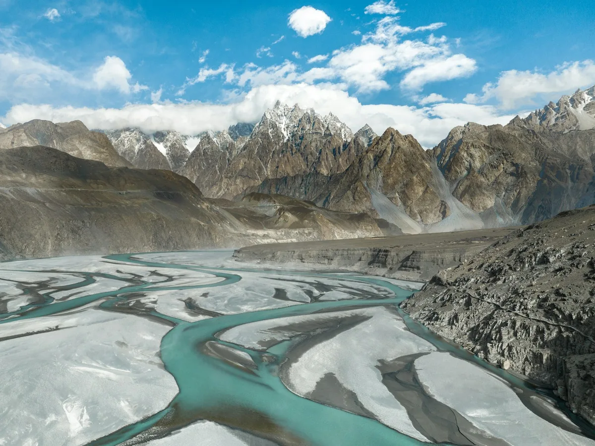
A high valley in Gilgit-Baltistan lined with apricot and cherry orchards beneath the Karakoram's Ultar Sar and Rakaposhi peaks, centered on the town of Karimabad.
Visitor guide
Hunza Valley is a mountain river valley in Gilgit-Baltistan, northern Pakistan, traversed by the Hunza River and by the Karakoram Highway. Its centre, Karimabad, lies beneath high Karakoram peaks and is the base for visits to the old forts of Baltit and Altit.
According to Wikipedia, the valley is also called the Hunza-Nagar Valley and is made up of three parts: Upper Hunza (Gojal), Central Hunza and Lower Hunza (Shinaki). The Hunza River forms near Passu from glacier-fed streams of the Karakoram, and the valley widens around Karimabad. At Danyor, it opens into the Gilgit Valley, where the Hunza River joins the Gilgit River. The valley floor sits at about 2,438 metres, and about 90 percent of its area lies above 3,000 metres.
Several peaks in the surrounding area rise above 7,000 metres, including Distaghil Sar (7,885 metres), Rakaposhi (7,788 metres) and Ultar Sar (7,388 metres). The Batura Glacier, at 57 km, is described as the fifth-longest glacier outside the polar regions, and the Khunjerab Pass, at roughly 4,700 metres (Pakistani tourism and UNESCO documents give 4,733 metres), is called the highest paved international border crossing in the world. The Main Karakoram Thrust runs through the area and is associated with natural hot springs.
The valley was a central node in trade routes linking Central Asia to the subcontinent. The Sacred Rock of Hunza has petroglyphs of horsemen and ibex, along with Kharoshthi inscriptions. Buddhism was the main religion before Islam, and most residents later became Ismaili Muslims. The Ayash family established rule in the 15th century, and Hunza's capital was Baltit, now Karimabad. Baltit Fort, on a hill above Karimabad, was the Mirs' former residence and is described by the Aga Khan Trust for Culture as over 700 years old, while UNESCO's tentative-list entry says 1990 conservation work indicated its core tower dates to the eighth century AD, while Altit Fort stands lower in the valley. The princely state survived until 1974, when Prime Minister Zulfiqar Ali Bhutto dissolved it.
Local languages include Burushaski, Wakhi and Shina. The literacy rate is reported as over 95 percent, which Wikipedia credits to community schools and Aga Khan-linked institutions, especially for girls. Claims that people in Hunza live exceptionally long lives are described in the article as a longevity myth, linked partly to missing birth records. The valley is popularly believed to have inspired the Shangri-La of James Hilton's 1933 novel Lost Horizon, though this is a popular association rather than a documented fact.
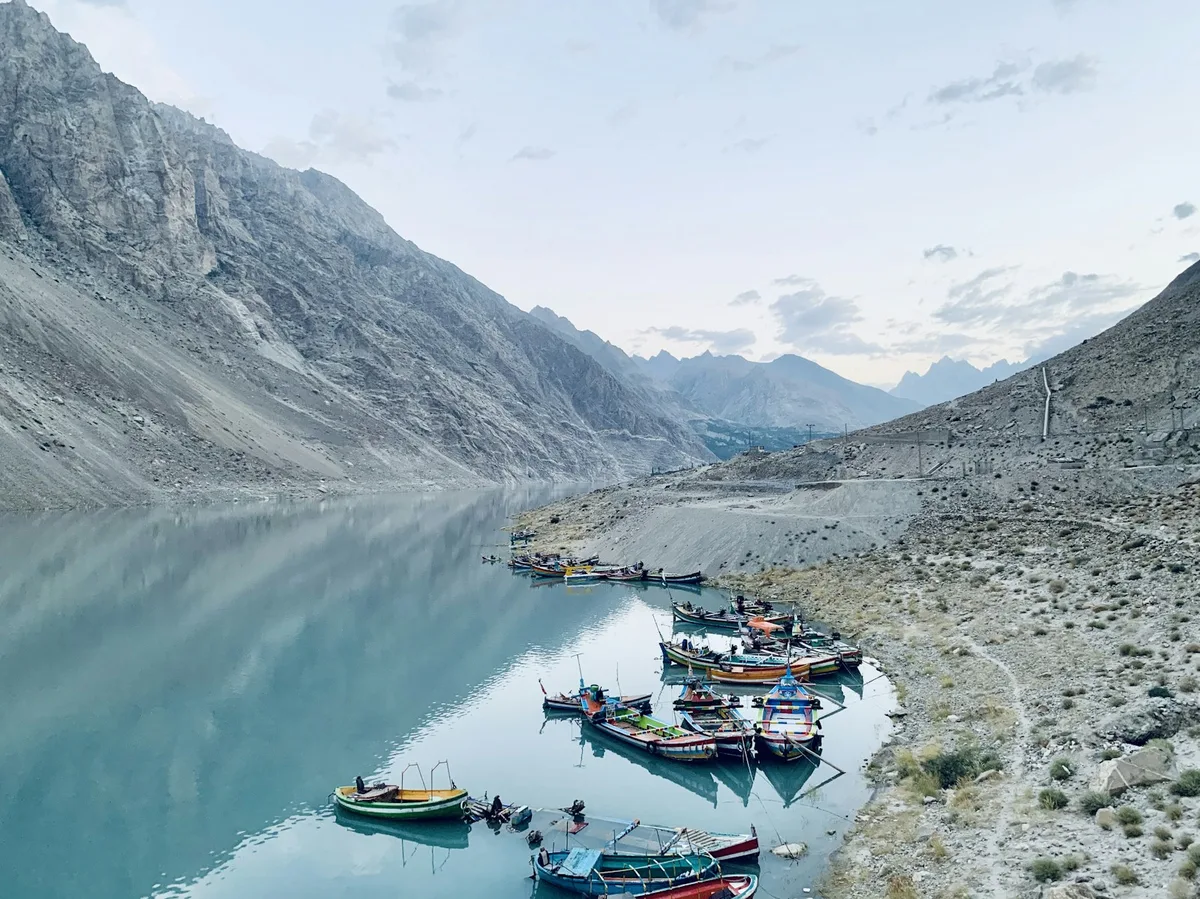
Wikipedia mentions apricot seeds and oil as part of the traditional local diet, one of several factors some sources cite for the residents' reputed health, though the article flags that claim as needing better sourcing. It also lists lakes including Attabad, Borith and Rush, meadows such as Kacheli and Barkot, and sub-valleys including Hopar, Naltar and Gappa. A landslide in January 2010 created Attabad Lake and blocked about 26 km of the highway, since rerouted through tunnels.
A private tour with a driver suits the long mountain highway, letting the group stop at Karimabad, the forts and the viewpoints without driving themselves.
See every tour and attraction we cover in Pakistan.