TorontoOntario · 36 tours
 Niagara FallsOntario · 25 tours
 New York CityNew York · 30 tours
 Las VegasNevada · 8 tours
 San FranciscoCalifornia · 16 tours
 VancouverBritish Columbia · 17 tours
 DubaiUAE · 54 tours
 Abu DhabiUAE · 5 tours
 Buenos AiresArgentina · 23 tours
 AthensGreece · 31 tours
 AucklandNew Zealand · 38 tours
 CancunMexico · 54 tours
No destinations match “”. Try searching all tours instead — that search understands full questions, not just place names.
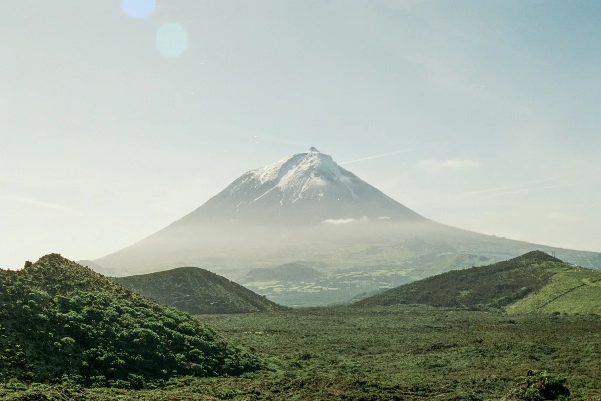
Portugal's highest mountain at 2,351 metres, a dormant volcanic cone that rises directly from the Atlantic and can be climbed on a guided day hike.
Visitor guide
Mount Pico is a dormant stratovolcano on Pico Island in the Azores, Portugal, rising 2,351 metres above sea level. It is the highest mountain in Portugal and more than twice the elevation of any other peak in the Azores, according to Wikipedia.
Mount Pico is described as a currently dormant stratovolcano whose rocks are less than 230,000 years old, with its present form dating to the Holocene based on radiocarbon dates under 6,000 years. It belongs to the Madalena Volcanic Complex, one of three volcanic units on Pico Island. The East Fissural Zone contains cinder cones and lava flows that formed fajas, or lava deltas, along the coast.
The summit has a round pit crater, Pico Alto, about 500 metres across and 30 metres deep. Inside it rises a small volcanic cone called Piquinho, or Pico Pequeno, about 70 metres high, which forms the true summit; both names mean small peak. Permanent degassing at Piquinho releases water vapour at 50 to 75 degrees Celsius. In September 2009 a visible plume was reported, but the monitoring agency CIVISA attributed it to exceptional weather and found no anomalous volcanic gases.
The most recent eruption is given as December 1720. Historical eruptions came from flank vents rather than the summit: a 1562 to 1564 eruption on the southeast flank sent lava to the sea, and a 1718 flank eruption also reached the coast. Major eruptions are linked to the Lomba de Fogo-Sao Joao fault system.
The Mount Pico Nature Reserve was established in 1972 and covers 13.41 square kilometres. It is classed as IUCN Category Ib, a wilderness area. The PICO-NARE observatory has operated since 1998 at about 2,225 metres in the summit caldera, studying air pollutants from North America and Europe over the North Atlantic. Mount Pico's isolation and low marine boundary layer make it well suited to such research.
The mountain dominates Pico Island, which lies about 7 kilometres east of Faial and covers roughly 445 square kilometres. Wikipedia calls Pico the geologically youngest Azorean island, at around 300,000 years old, and notes its nickname Ilha Preta, or Black Island, for its dark volcanic soils. Settlement began in the 1480s. The mountain's northeastern flanks receive over 5,000 millimetres of rain a year, and snow can fall near the summit, which helps explain why conditions on the cone can differ so sharply from those at the coast.
The island's relationship with its volcano also appears in its farming and culture. Pico's vineyard landscape has been a UNESCO World Heritage Site since 2004, with viticulture beginning in the late 15th century and verdelho wine widely exported until phylloxera and powdery mildew caused a decline in the mid-19th century. Sperm whaling was the main industry until it was abolished in 1986, and the former whale factory is now a museum. The island is also credited with 86 of the Azores' 225 lava caves, a reminder of how much of its landscape is shaped by volcanic processes.
The easiest route is a scramble rated Class 2, according to Wikipedia, which cites more than 20,000 visitors in 2019. Climbs are physically demanding and weather on a high volcano can change quickly, so a local guide is a sensible choice. A private vehicle and driver can handle transfers on Pico Island.
See every tour and attraction we cover in Azores.