TorontoOntario · 36 tours
 Niagara FallsOntario · 25 tours
 New York CityNew York · 30 tours
 Las VegasNevada · 8 tours
 San FranciscoCalifornia · 16 tours
 VancouverBritish Columbia · 17 tours
 DubaiUAE · 54 tours
 Abu DhabiUAE · 5 tours
 Buenos AiresArgentina · 23 tours
 AthensGreece · 31 tours
 AucklandNew Zealand · 38 tours
 CancunMexico · 54 tours
No destinations match “”. Try searching all tours instead — that search understands full questions, not just place names.
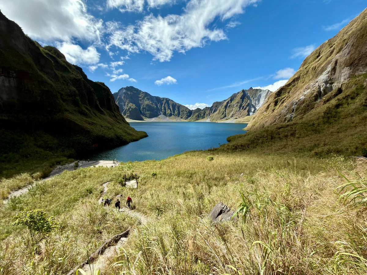
A volcano north of Manila whose 1991 eruption was one of the 20th century's largest, its collapsed crater now holding a turquoise lake reached by a 4x4-and-hike trip through ash-carved canyons.
Visitor guide
Mount Pinatubo is an active stratovolcano in the Zambales Mountains on Luzon in the Philippines, about 87 km northwest of Manila. Its June 1991 eruption was one of the largest of the 20th century and left a caldera that now holds a crater lake.
According to Wikipedia, Pinatubo sits at the tripoint of Zambales, Tarlac and Pampanga provinces. Before 1991 it stood at 1,745 metres but only about 600 metres above the surrounding plains, which kept it largely hidden, and its present summit is about 1,486 metres. It is a subduction-related volcano where the Eurasian plate slides beneath the Philippine Mobile Belt along the Manila Trench. The older Pinatubo was an andesite and dacite stratovolcano, within which the modern cone formed.
The climactic eruption took place on 15 June 1991 and is rated VEI 6. Wikipedia calls it the second-largest terrestrial eruption of the 20th century after Novarupta in 1912. It ejected about 10 cubic kilometres of material and roughly 20 million tonnes of sulphur dioxide, and the ash column rose about 35 km. Pyroclastic flows filled valleys with deposits up to 200 metres thick, and the summit collapsed into a caldera about 2.5 km wide. The eruption coincided with Typhoon Yunya, which spread ash and rain. Early warnings led to the evacuation of tens of thousands of people.
Rain-driven lahars remobilised the deposits and reshaped river systems for years. The eruption put more particulate into the stratosphere than any since Krakatoa in 1883, and global temperatures dropped about 0.5 degrees Celsius in 1991 to 1993. Wikipedia also records that an earlier eruption, the Buag eruption around AD 1500, was roughly comparable in size.
The 1991 caldera filled with monsoon rainwater to form a crater lake. Early on, the lake was hot and acidic, at about 40 degrees Celsius and pH 2, but by 2003 it had cooled to 26 degrees with a pH of 5.5. In September 2001 the government ordered a controlled drain after fears the crater walls were unstable, and in July 2002 the west wall of the crater collapsed. The lake now draws tourists, usually via Barangay Santa Juliana in Capas, Tarlac.
The name may mean fertile place or made to grow in Sambal and Tagalog. Aeta elders describe the mountain through stories of Apo Namalyari. In 2010 about 7,000 Aeta families from Zambales received a Certificate of Ancestral Domain Title covering 15,984 hectares including the summit and Lake Pinatubo, and in 2009 about 454 families in Pampanga received a title for 7,440 hectares.
The long-nosed forest mouse is endemic to Mount Pinatubo, and the Zambales forest mouse is endemic to the Zambales range. About 6 million people live near the volcano. The crater is reached on a hike from the Capas side, so a private tour with a driver and a local guide is a practical way to organise the visit.
See every tour and attraction we cover in Philippines.