TorontoOntario · 36 tours
 Niagara FallsOntario · 25 tours
 New York CityNew York · 30 tours
 Las VegasNevada · 8 tours
 San FranciscoCalifornia · 16 tours
 VancouverBritish Columbia · 17 tours
 DubaiUAE · 54 tours
 Abu DhabiUAE · 5 tours
 Buenos AiresArgentina · 23 tours
 AthensGreece · 31 tours
 AucklandNew Zealand · 38 tours
 CancunMexico · 54 tours
No destinations match “”. Try searching all tours instead — that search understands full questions, not just place names.
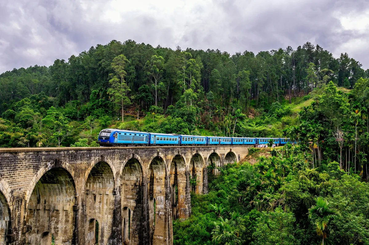
A colonial-era railway viaduct in the hill country, famous for the blue train crossing its nine stone arches through the tea-covered hills.
Visitor guide
The Nine Arch Bridge, also called the Bridge in the Sky, is a railway viaduct at Demodara near Ella in Sri Lanka's Badulla District. Completed in 1919 on the island's hill-country railway, it is one of the best-known examples of colonial-era railway construction in Sri Lanka, set among tea country and forested hills.
The viaduct is about 91 metres long, 7.6 metres wide and 24 metres high, with nine spans carrying a single non-electrified track of 5 foot 6 inch gauge. Wikipedia says it was designed to take a sharp nine-degree curve and a steep gradient, which explains its gently curving profile. The builders used stone, brick and cement: concrete cornice blocks support the arches, and locally made sand-cement blocks form the facing. It stands between the Ella and Demodara railway stations and is owned by Sri Lanka Railways, and it has been protected as an archaeological monument.
Local labour built the viaduct under British supervision, and Wikipedia notes that difficult terrain and the transport of materials made the work hard. Harold Cuthbert Marwood, the engineer in charge of that section, is named as designer, with the work approved by the Chief Construction Engineer, M. Cole Bowen. D. J. Wimalasurendra, a Ceylonese engineer and inventor, is named as chief designer and project manager of the upcountry line. A 1923 report by the Engineering Association of Ceylon, titled Construction of a Concrete Railway Viaduct in Ceylon, preserves the plans and drawings.
A widely repeated story says construction coincided with the start of World War I and that steel meant for the bridge was diverted to British war projects. In that telling, work stalled and local people finished the bridge in stone and cement with no steel except the rails and pins fixing them. This is a rumour recorded by Wikipedia and should be read as local lore. Folklore also credits a Ceylonese builder, P. K. Appuhami, working with British engineers, but Wikipedia states there is no documented evidence for his involvement.
The bridge belongs to the Main Line, which Wikipedia describes as opening in stages from Colombo in the 1860s, reaching Kandy in 1867, Nanu Oya in 1885, Bandarawela in 1894 and the terminus at Badulla in 1924. The line climbs through tea country, reaching a summit at Pattipola of about 1,898 metres. Ella station, 271 km from Colombo, opened in July 1918, and the Demodara Loop, a spiral section of track, lies at Demodara. Wikipedia describes the railway as offering views of tea gardens, mountains, valleys and waterfalls.
Ella is a small town about 1,041 metres above sea level, cooler than the lowlands, with cloud forest and tea plantations around it and the Ella Gap opening views toward the southern plains. Wikipedia lists nearby sights including Little Adam's Peak, Ella Rock, the Ravana Ella waterfall and the Dhowa rock temple. A private tour with a local driver and guide can combine the bridge with these stops around Ella.
See every tour and attraction we cover in Sri Lanka.