TorontoOntario · 36 tours
 Niagara FallsOntario · 25 tours
 New York CityNew York · 30 tours
 Las VegasNevada · 8 tours
 San FranciscoCalifornia · 16 tours
 VancouverBritish Columbia · 17 tours
 DubaiUAE · 54 tours
 Abu DhabiUAE · 5 tours
 Buenos AiresArgentina · 23 tours
 AthensGreece · 31 tours
 AucklandNew Zealand · 38 tours
 CancunMexico · 54 tours
No destinations match “”. Try searching all tours instead — that search understands full questions, not just place names.
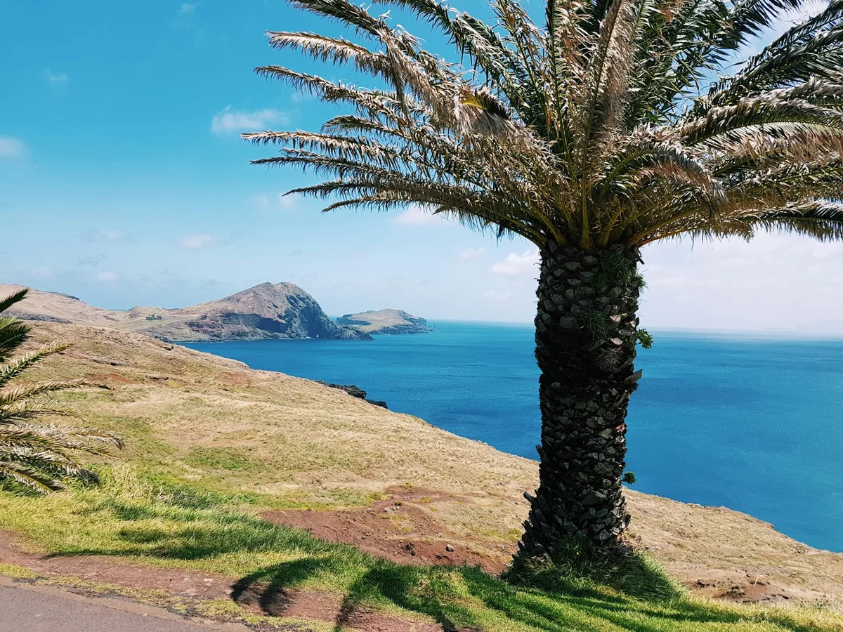
A dramatic, arid volcanic peninsula at Madeira's easternmost tip, laced with hiking trails along sheer cliffs and sea stacks — a striking contrast to the island's lush interior.
Visitor guide
Ponta de São Lourenço is a rocky headland at the easternmost end of Madeira, Portugal, within the municipality of Machico near the town of Caniçal. Its name means Point of Saint Lawrence, and it is a protected nature reserve known for its dry landscape, sea cliffs and island views.
Wikipedia describes a rocky terrain with herbaceous vegetation, whose highest point is Pico do Furado. The geology includes pyroclastic rocks, basalt dykes and eroded coastlines, and the rocks date from the late Pleistocene, about 100,000 years ago. Gallery images on the Wikipedia page show features such as the Baía d'Abra beach and the Pedra Furada rock arch. The scenery contrasts with the greener interior of the island.
The peninsula was brought under protection within the Madeira Natural Park in 1982, later held Reserva Natural status, and is now classified by the regional government as a Monumento Natural (2021); it is also part of the Natura 2000 network. Wikipedia lists endemic plants conserved there, including Matthiola maderensis, Echium nervosum and Andryala glandulosa. Fauna includes birds, insects, molluscs and the monk seal, and marine life inhabits the surrounding waters. Together with the islets Ilhéu da Cevada and Ilhéu do Farol, the headland is recognised as an Important Bird Area by BirdLife International. It hosts nesting seabird colonies; the regional nature agency (IFCN) notes that one of the region's largest yellow-legged gull colonies nests on Ilhéu da Cevada, a gull Wikipedia describes as the Caspian gull, so the species naming differs by source.
The islet of Ilhéu do Farol is the easternmost in the group and holds the Ponta de São Lourenço lighthouse. Porto Santo lies to the northeast, and the Desertas Islands, including Bugio, lie to the southeast. To the west is the New Port of Madeira at Caniçal. Wikipedia also lists Quinta do Lorde and the levada route between Caniçal and Boca do Risco among the nearby features.
A path from the entrance of the headland takes about an hour to walk, according to Wikipedia, and Wikipedia does not give a total trail length. The route runs along cliffs, small bays and viewpoints, with steps and exposed sections. There is little shade on the path, and wind can be strong, so sun protection and sturdy shoes are important. The time of day and season affect the colours of the landscape and the visitors' comfort.
The reserve is part of the wider Madeira Natural Park, which Wikipedia says was established in 1982 and covers 444 square kilometres of the island. Madeira's native flora is rich: the archipelago has about 1,226 native vascular plant species, 66 of them endemic to the islands, and endemic birds across the islands include the Madeira firecrest and Zino's petrel. Because of this, the peninsula is as much a botanical and birdwatching site as a scenic walk.
The peninsula is a short drive from Funchal and from the airport area. A private driver can drop off at the trail entrance, and a guide can point out the geology, plants and seabirds. Because trail conditions and access rules can change, it is worth checking the current guidance of the Madeira Natural Park before visiting. The headland offers a very different view of the island from the green mountain interior, and it pairs well with stops at nearby Machico or Caniçal.
See every tour and attraction we cover in Madeira.