TorontoOntario · 36 tours
 Niagara FallsOntario · 25 tours
 New York CityNew York · 30 tours
 Las VegasNevada · 8 tours
 San FranciscoCalifornia · 16 tours
 VancouverBritish Columbia · 17 tours
 DubaiUAE · 54 tours
 Abu DhabiUAE · 5 tours
 Buenos AiresArgentina · 23 tours
 AthensGreece · 31 tours
 AucklandNew Zealand · 38 tours
 CancunMexico · 54 tours
No destinations match “”. Try searching all tours instead — that search understands full questions, not just place names.
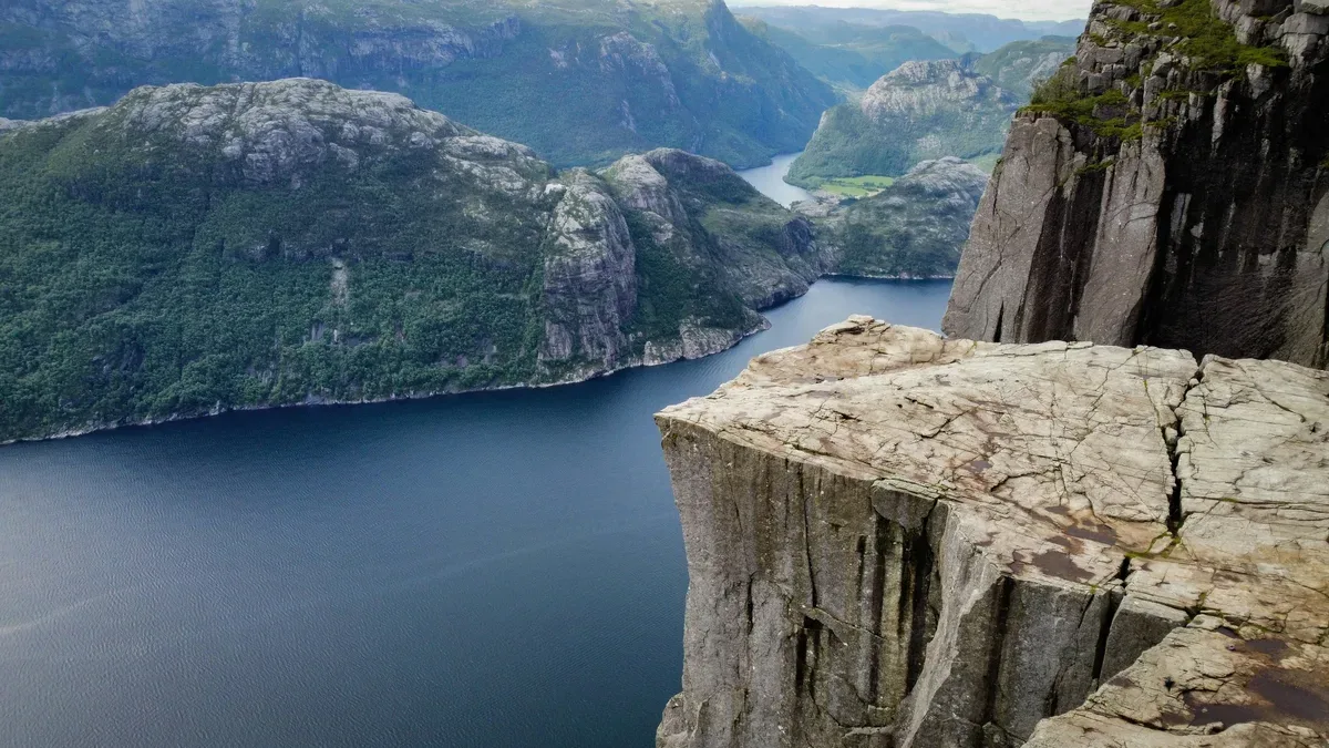
A flat-topped cliff rising 604m above Lysefjorden, reached by one of Norway's most iconic day hikes near Stavanger.
Visitor guide
Preikestolen, in English Pulpit Rock, is a granite cliff in Strand Municipality, Rogaland county, in south-western Norway. It rises 604 metres above Lysefjorden and has a flat top of about 25 by 25 metres. It is one of Norway's most-visited natural attractions, reached by a marked hiking trail from the area near Stavanger.
According to Wikipedia, the cliff took its shape during the Last Glacial Period, about 10,000 years ago, when the edge of the glacier reached it. Water from the glacier froze in cracks in the rock, breaking off large angular blocks that the ice then carried away, which explains the plateau's angular form. A deep crack runs along the plateau, but geological studies indicate it will not fall in the foreseeable future.
The old local name for the formation was Hyvlatonnå, roughly Plane's Tooth. The name Prekestolen was coined around 1900 by the local tourist organisation Stavanger Turistforening to promote hiking here, and an i was later added to match Nynorsk, giving the official name Preikestolen.
The road ends at a car park at Preikestolen Fjellstue, south of Jørpeland, and the main trail is about 3.8 kilometres each way. A round trip for someone of average fitness takes around three to four hours. The path starts at about 270 metres above sea level and climbs to 604 metres, but the total ascent and descent is greater than that difference suggests because the trail crosses several ridges. Winter and spring hikes are harder because of snow and ice, and the top is sometimes unreachable in winter.
In April 2013 a project began to widen the old path, which had been too narrow and sometimes impassable. Nepalese Sherpas helped build the new stone steps, and the work was completed by 2016. A further project from 2019 improved paths and signage. An alternative route from Bratteli, a tourist ferry stop, passes beneath the rock and takes four to five hours each way.
From the plateau the cliff overlooks the valleys of the Ryfylke region and the length of Lysefjorden, with nearby mountains rising to 843 metres. Authorities chose not to install fences or other barriers, partly to preserve the landscape and partly because they feared fences could encourage risky behaviour. Wikipedia notes that fatalities are very rare despite hundreds of thousands of annual visitors, and that about 300,000 visitors were reported in 2024. BASE jumpers often leap from the cliff.
Stavanger is about 25 kilometres away as the crow flies, and the car park is roughly 40 minutes' drive from the city, partly thanks to the Ryfylke underwater tunnel, which opened in April 2020. Boat trips through Lysefjorden run year-round, and outside summer the weather can be wet, cold and cloudy. The area has a mild, humid coastal climate.
The cliff appears in the final scene of the second-season finale of the television series Vikings, and the final fight scene of the film Mission: Impossible - Fallout was filmed here, though the story is set in Kashmir. A Tamil film, Ko, also features a dance sequence on the clifftop.
Because the hike is a half-day outing with a steady climb, comfortable footwear and weather-appropriate clothing matter. A private guided transfer from Stavanger takes care of the road leg so that time and energy go to the trail itself.
See every tour and attraction we cover in Norway.