TorontoOntario · 36 tours
 Niagara FallsOntario · 25 tours
 New York CityNew York · 30 tours
 Las VegasNevada · 8 tours
 San FranciscoCalifornia · 16 tours
 VancouverBritish Columbia · 17 tours
 DubaiUAE · 54 tours
 Abu DhabiUAE · 5 tours
 Buenos AiresArgentina · 23 tours
 AthensGreece · 31 tours
 AucklandNew Zealand · 38 tours
 CancunMexico · 54 tours
No destinations match “”. Try searching all tours instead — that search understands full questions, not just place names.
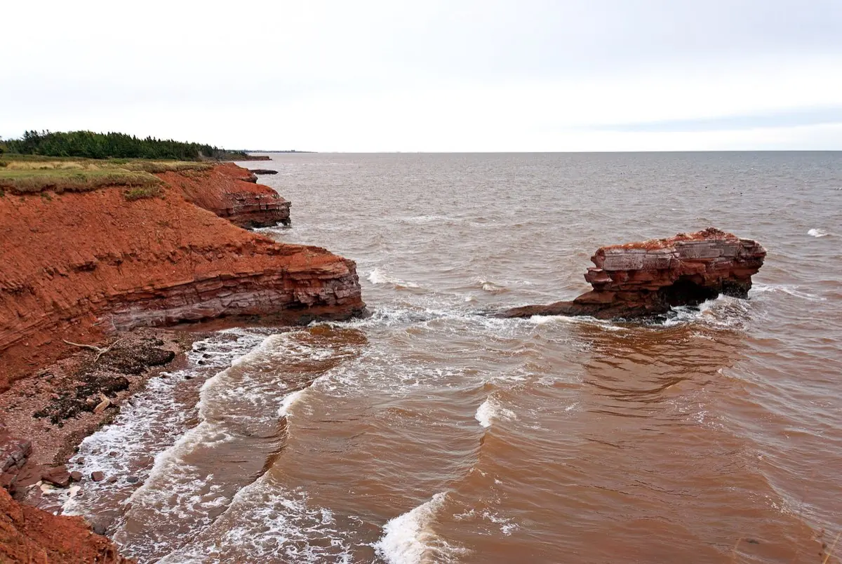
PEI's iron-rich red cliffs and beaches, found along much of the island's shore.
Visitor guide
Prince Edward Island's red coastline is less a single site than a defining trait of the whole Island: cliffs, beaches and ploughed fields share the same rusty colour, set against green crops and blue water. The colour comes from iron in the bedrock, and the same soft rock that gives the shore its look also makes it one of the more quickly changing coastlines in Atlantic Canada.
The Island's bedrock is mostly red sandstone and siltstone laid down in the late Paleozoic era, when rivers carried sediment from distant highlands into a long, sinking basin known as the Maritime Rift. Sources describe up to 12 kilometres of sediment filling that rift. Local geologists date the surface rocks to the Permian period, roughly 250 to 300 million years ago, though the exact range is quoted a little differently from source to source.
The rock was not red when it was deposited. Iron minerals in the sediment oxidized, in effect rusted, on exposure to air and water, and that iron oxide stains the cliffs, the sand eroded from them, and the clay soils of the Island's farmland. In places, small grey-green circles appear in the red stone; naturalists explain these as spots where a tiny speck of metal or mineral chemically stripped oxygen from the surrounding iron, restoring the rock's original pale colour.
Sandstone is crumbly compared with the granite and basalt that line many other coasts, and the cliffs often carry glacial till on top, which is even less stable. Parks Canada notes that rising seas over some 8,000 years, and more recently stronger storms and reduced winter sea ice, have been reshaping the shoreline, and that erosion has been accelerated by climate change. Cliffs can be undercut, so ground that looks solid from above may give way underfoot. Many protected areas fence or sign cliff edges for exactly this reason, and visitors should heed those signs and keep back from the edge.
The same erosion that endangers the cliffs also exposes older layers of rock. Parks Canada notes that erosion reveals new fossil layers each year, and that notable finds in Prince Edward Island National Park include a partial Dimetrodon skull and footprints. The cliffs also shelter nesting bank swallows, a species listed as threatened under Canada's Species at Risk Act since 2017, which is another reason the edges are best admired from a distance.
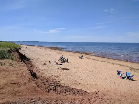
Red sand and red sandstone appear at many points around the Island's shoreline, which is often quoted as about 1,100 kilometres long, including several beaches within Prince Edward Island National Park on the north shore. The harbour at North Rustico, for example, is described in its heritage register entry as having a red clay shoreline. The colour is also woven into the Island's identity: Lucy Maud Montgomery, who grew up on the north shore, repeatedly wrote of red roads and red shores in the Anne books.
The colour is richest in low, slanting light near sunrise and sunset, and wet sand reads darker and redder than dry. Because there is no single red-sand beach to aim for, it helps to choose a shoreline stop that also has safe viewing, such as a supervised beach or an established lookout. Tide levels, cliff closures and beach access change, so check Parks Canada or the relevant municipality for current conditions before you go.
On a Voyzo private tour, a private vehicle and driver can link the red shoreline with other north-shore and Charlottetown stops in a single door-to-door day, with time to pause where the light and the footing are good.
See every tour and attraction we cover in Charlottetown.