TorontoOntario · 36 tours
 Niagara FallsOntario · 25 tours
 New York CityNew York · 30 tours
 Las VegasNevada · 8 tours
 San FranciscoCalifornia · 16 tours
 VancouverBritish Columbia · 17 tours
 DubaiUAE · 54 tours
 Abu DhabiUAE · 5 tours
 Buenos AiresArgentina · 23 tours
 AthensGreece · 31 tours
 AucklandNew Zealand · 38 tours
 CancunMexico · 54 tours
No destinations match “”. Try searching all tours instead — that search understands full questions, not just place names.
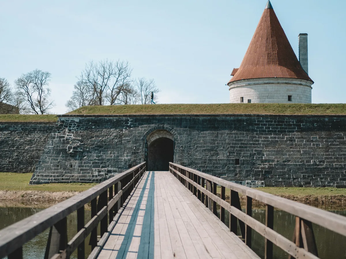
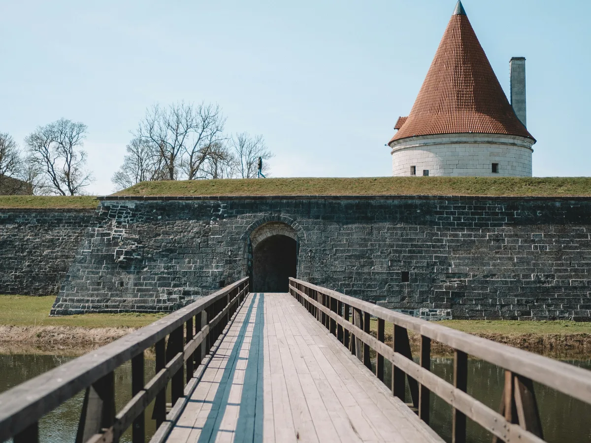
Estonia's largest island, reached by ferry, centered on the moated Kuressaare Episcopal Castle — one of the best-preserved medieval fortresses in the Baltics — and surrounded by windmills, cliffs, and juniper-covered coastline.
Visitor guide
Saaremaa is the largest island of Estonia, in the Baltic Sea, and Kuressaare Castle is its best-known landmark. Located in the island's main town of Kuressaare, the castle is one of the best-preserved medieval fortifications in Estonia and today houses the Saaremaa Museum.
Saaremaa covers 2,673 square kilometres and had 31,435 residents in 2020, according to Wikipedia. It lies south of Hiiumaa and northwest of the Gulf of Riga, and for centuries was known abroad as Osel. People have lived there since at least 5000 BCE, and Iron Age ship burials from around 700 to 750 CE have been found on the Sorve Peninsula. The island is a low-lying limestone plain, with limestone exposed in cliffs such as Panga Cliff. The juniper is one of its symbols and over 40 percent of the land is forested.
Kaali is a group of nine meteorite craters, the largest about 110 metres across and holding Lake Kaali. Its age is uncertain: Wikipedia cites a commonly accepted date of 4000 BCE with a margin of 1000 years, other studies suggest around 660 BCE, and Visit Estonia says the meteorite fell about 7,500 years ago. The island also has several medieval churches, including those at Kaarma, Karja, Kihelkonna, Pohde and Valjala.
The earliest written record of the castle is from the 1380s, when the Teutonic Order began construction for the bishops of Osel-Wiek, and it remained one of the bishopric's most important castles until the bishopric was dissolved during the Livonian War. A wall about 625 metres long was built around the castle at the end of the 14th and start of the 15th century. The style is late Gothic, with a square convent building around a central courtyard and a defence tower in the north corner that is 37 metres high. The cellar held storage and a hypocaust heating system, and the bishop's quarters display eleven Baroque carved epitaphs of Saaremaa noblemen.
In 1559 Denmark-Norway took Saaremaa and the castle, and after the Peace of Bromsebro in 1645 it passed to Sweden. Erik Dahlbergh designed a Vauban-type fortress with bastions and ravelins, much of which survives. After the Great Northern War the island became part of the Russian Empire, and the Russian garrison blew up much of the fortifications when it left in 1711. In the 19th century the castle served as a poorhouse, and from 1861 the bastions were turned into a park. A spa opened in Kuressaare, then called Arensburg, in 1840, and the town became a popular seaside resort.
Saaremaa is reached by ferry from the mainland via the island of Muhu, so a private guided journey with a driver is a practical way to connect the ferry, the castle and the island's sights. Tourism is significant on the island, and the main gateways are Kuressaare Airport and Roomassaare Harbour. The island's roughly 1,200 vascular plant species represent about 80 percent of Estonia's total, and hundreds of thousands of migratory birds pass through each spring and autumn along the East Atlantic Flyway.
See every tour and attraction we cover in Estonia.