TorontoOntario · 36 tours
 Niagara FallsOntario · 25 tours
 New York CityNew York · 30 tours
 Las VegasNevada · 8 tours
 San FranciscoCalifornia · 16 tours
 VancouverBritish Columbia · 17 tours
 DubaiUAE · 54 tours
 Abu DhabiUAE · 5 tours
 Buenos AiresArgentina · 23 tours
 AthensGreece · 31 tours
 AucklandNew Zealand · 38 tours
 CancunMexico · 54 tours
No destinations match “”. Try searching all tours instead — that search understands full questions, not just place names.
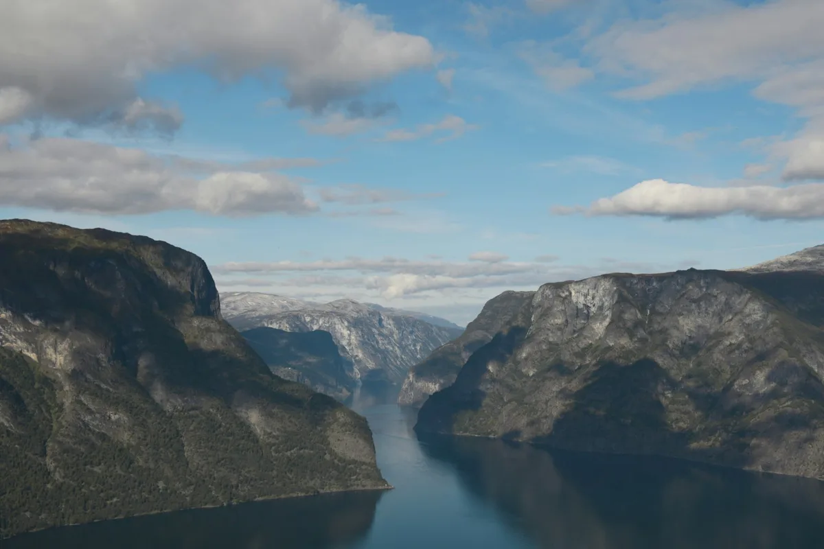
Norway's longest and deepest fjord at 205 km long and about 1,300 metres deep, cutting inland from the coast near Bergen toward branch fjords including the Nærøyfjord.
Visitor guide
The Sognefjord, or Sognefjorden, is Norway's longest and deepest fjord, lying in Vestland county. It is nicknamed the King of the Fjords and runs about 205 kilometres inland from the coast to Skjolden in Luster Municipality. The fjord gives its name to the surrounding Sogn district and has several famous branches, including the UNESCO-listed Nærøyfjord.
Wikipedia gives the length as 205 kilometres and the maximum depth as 1,308 metres, found near Høyanger, while Store norske leksikon gives about 1,303 metres, so treat the depth as approximate. The fjord is up to about 6 kilometres wide, with the main branch averaging under 5 kilometres. For about 100 kilometres, from Rutledal to Hermansverk, it is more than 1,000 metres deep, but near the mouth the bottom rises to a sill roughly 100 metres below sea level. The fjord holds about 500 cubic kilometres of water. Cliffs rise nearly vertically from the water to 1,000 metres or more.
The valley predates the Quaternary glaciations and was part of an older land surface with gentler slopes. Uplift of the Scandinavian Mountains let rivers cut deeply into that surface, and glaciers then followed existing structural weaknesses in the crust. During the last glaciation the ice reached nearly 3,000 metres thick. The confluence of tributary glaciers carved the deepest basin, and sediments about 200 metres thick now cover the seabed.
The Sognefjord has many arms, including Fjærlandsfjord, Aurlandsfjord, Nærøyfjord, Lustrafjord, Sogndalsfjord, Årdalsfjord and Lærdalsfjord. Nærøyfjord is about 18 kilometres long and only around 300 metres wide at its narrowest, according to this article. The fjord passes through ten municipalities, among them Solund, Gulen, Høyanger, Vik, Sogndal, Lærdal, Aurland, Årdal and Luster. Villages on the shore include Balestrand, Flåm, Gudvangen, Lærdalsøyri and Solvorn, and Skjolden at the inner end is an access point to Jotunheimen National Park.
The inner end lies southeast of a range near 2,000 metres covered by Jostedalsbreen, described as continental Europe's largest glacier. The Hurrungane range at the eastern end reaches 2,400 metres. Because of the surrounding mountains the inner area has a drier climate than the outer coast, and several rivers feed the fjord, with an annual spring flood in June.
The Flåm Railway climbs about 864 metres to Myrdal station over roughly 20 kilometres and is among the steepest unassisted railway climbs in the world. The stave churches at Kaupanger and Urnes stand along the shoreline, and Borgund is about 30 kilometres into the Lærdal valley. An 1853 painting by Hans Gude and Adolph Tidemand depicts the fjord, showing how long it has attracted artists. Summer tourism is an important part of the local economy.
Many ferry crossings operate on the Sognefjord, including MV Ampere, described as the world's first battery-electric car ferry, which crosses between Lavik and Oppedal. Power lines cross the fjord over a span of 4,597 metres, described as the second longest span of power lines in the world. Historically, travel between Bergen and the interior used boats to Skjolden and then a highland road, now County Road 55, or boats to Lærdal and a mountain pass to Valdres, now the E16.
Because the fjord is so long, trips usually focus on one or two arms. A private tour can combine a ferry crossing with the villages and viewpoints around a chosen branch, and local conditions such as weather and ferry timetables shape the day.
See every tour and attraction we cover in Norway.