TorontoOntario · 36 tours
 Niagara FallsOntario · 25 tours
 New York CityNew York · 30 tours
 Las VegasNevada · 8 tours
 San FranciscoCalifornia · 16 tours
 VancouverBritish Columbia · 17 tours
 DubaiUAE · 54 tours
 Abu DhabiUAE · 5 tours
 Buenos AiresArgentina · 23 tours
 AthensGreece · 31 tours
 AucklandNew Zealand · 38 tours
 CancunMexico · 54 tours
No destinations match “”. Try searching all tours instead — that search understands full questions, not just place names.
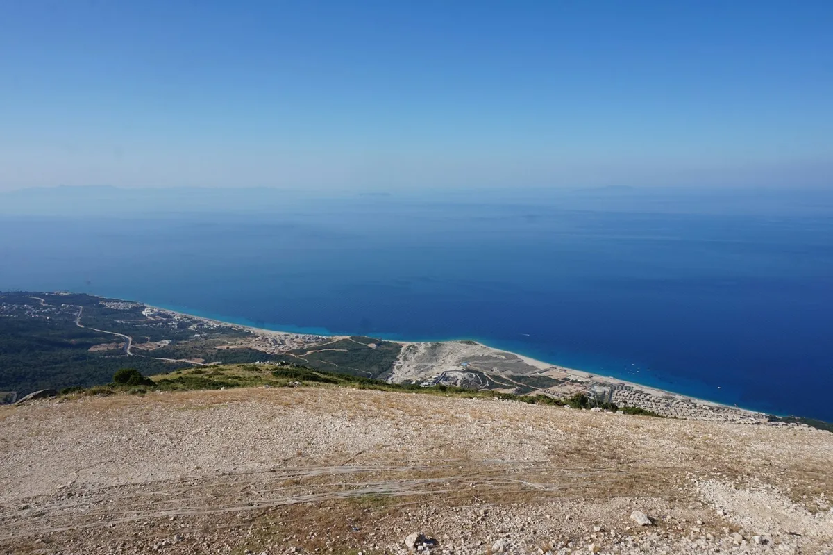
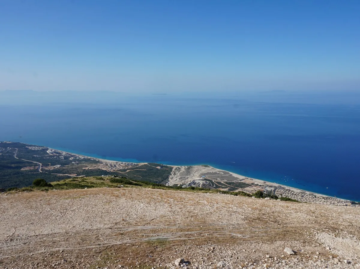
A mountain pass on the Albanian Riviera road where pine forest gives way suddenly to a sweeping view down to the Ionian Sea coastline.
Visitor guide
The Llogara Pass is a high mountain pass in the Ceraunian Mountains on the Albanian Riviera, in southwestern Albania. It connects the Dukat Valley in the north with the coastal area around Himare in the south, and sits within Llogara National Park. At about 1,027 metres, it offers wide views over the Ionian Sea and its islands.
According to Wikipedia, the pass rises to 1,027 metres between the peaks of Maja e Cikes and Maja e Gjipalit, and forms the watershed between the Adriatic Sea to the north and the Ionian Sea to the south. The road runs from Orikum, near the southern end of Vlora Bay, over the pass and down toward Dhermi on the coast. On the southern side the ground is rugged and steep: the Ionian coast is only about three kilometres away but more than 1,000 metres below. Wikipedia notes that the pass splits the Ceraunian chain into two ranges, with the western portion extending along the Karaburun Peninsula. The highest peaks of the chain are Maja e Cikes at 2,045 metres and Maja e Qorres at 2,018 metres.
The mountains are composed mainly of limestones, dolomites and flysch deposits, and sit on a line where two tectonic zones meet. The coastal climate is Mediterranean with subtropical influences, with hot summers and mild to cool winters, while an alpine climate prevails near the top of Maja e Cikes.
The pass is part of Llogara National Park, established in 1966 to protect ecosystems and biodiversity of national importance. Wikipedia gives its size as 1,769 hectares in one place and 1,010 hectares in another, so the exact area depends on the source. The IUCN lists the park as Category II. The terrain includes alpine meadows, vertical rock faces, precipices and dense forests, with altitudes from a few hundred metres (about 470 m by one park source) up to over 2,000 metres.
The forests include Bosnian pine, black pine, Bulgarian fir, silver fir, ash and kermes oak. Wikipedia mentions that air currents through the area have bent some trees into unusual shapes, such as the Pisha e Flamurit, the Flag Pine. Animals of conservation interest include the griffon vulture, golden eagle, rock partridge, fallow deer, roe deer, European wildcat, chamois, otter and wolf. The area is recognised as an important bird and plant area.
Tourism is the park's most important sector. Along the national road over the pass there are restaurants, hotels and a small wooden cabin complex, along with vendors selling honey and mountain tea. Hiking is popular in the surrounding mountains. A paragliding site south of the park has hosted the FAI World Paragliding Accuracy Championship, according to Wikipedia. Nearby is Caesar's Pass, named for Julius Caesar, who is said to have marched near the area in pursuit of Pompey.
The road over the pass is winding, with many bends and viewpoints, so a private tour with a driver who knows the route allows passengers to take in the scenery without worrying about the driving. The pass is often part of a coastal journey that links Vlora, the beaches of the Riviera and Sarande. Conditions vary with season and weather, and early or clear days give the longest views.
See every tour and attraction we cover in Albania.