TorontoOntario · 36 tours
 Niagara FallsOntario · 25 tours
 New York CityNew York · 30 tours
 Las VegasNevada · 8 tours
 San FranciscoCalifornia · 16 tours
 VancouverBritish Columbia · 17 tours
 DubaiUAE · 54 tours
 Abu DhabiUAE · 5 tours
 Buenos AiresArgentina · 23 tours
 AthensGreece · 31 tours
 AucklandNew Zealand · 38 tours
 CancunMexico · 54 tours
No destinations match “”. Try searching all tours instead — that search understands full questions, not just place names.
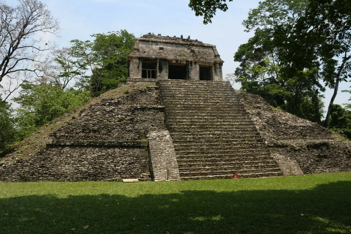
A Maya city-state in the Chiapas jungle, with the Temple of the Inscriptions (burial site of King Pakal) and intricately carved palace complex rising out of dense rainforest.
Visitor guide
Palenque is a Maya city-state in the state of Chiapas, southern Mexico, near the Usumacinta River. Its ruins, dating from about 226 BC to about 799 AD, rise from tropical forest and include some of the finest Maya architecture, sculpture and relief carving, and the site is a UNESCO World Heritage Site.
The ancient name of the city is usually given as Lakamha, commonly translated as big water. Palenque is smaller than Tikal, Chichen Itza or Copan, but Wikipedia describes it as holding some of the finest Maya architecture, roof combs and bas-relief carving. After the city declined, forest of cedar, mahogany and sapodilla trees covered it until excavation began. Much of its history is known from hieroglyphic inscriptions, which reveal a long sequence of rulers from the 5th century onward, repeated wars with Calakmul and Tonina, and several women rulers, including Sak K'uk', who governed for about three years before passing power to her son.
K'inich Janaab' Pakal, known as Pakal the Great, ruled from 615 to 683 AD. He came to power as a child, and Palenque recovered and grew under him; most of its major palaces and temples were built during his reign. His reign briefly brought the city to prominence comparable to Tikal.
This pyramid began as Pakal's funerary monument. It is about 60 meters wide and 27 meters high, and its superstructure holds the second-longest known Maya hieroglyphic text, covering roughly 180 years of the city's history. In 1952 Alberto Ruz Lhuillier lifted a floor slab inside and found a stairway leading down to Pakal's tomb, then the richest scientifically excavated burial known from the ancient Americas. The sarcophagus lid shows Pakal in the form of the maize god, a jade mosaic mask covered his face, and a shaft called a psychoduct is believed to represent the passage of the soul after death.
The Palace is a large complex of connected buildings and courtyards built over about four centuries on an artificial terrace. It served as a residence and as a center for administration and ceremony, and its four-story tower is the site's most recognizable structure. Corbel arches create its tall, narrow passageways, and an aqueduct channels the Otulum River beneath the main plaza. The Temples of the Sun, the Cross and the Foliated Cross stand on step pyramids in the Group of the Cross. Their inner chambers hold reliefs that later epigraphic work linked to Pakal's son, K'inich Kan B'ahlam, shown at a childhood ritual and at his accession.
The Maya of Palenque built a network of aqueducts and vaulted channels to manage flooding and supply fresh water. In 2010 researchers identified the Piedras Bolas conduit as a pressurized aqueduct, described by Wikipedia as the earliest known in the New World.
Colonel Antonio del Rio's expedition of 1786 produced the first map and drawings of the ruins. Later visitors included John Lloyd Stephens and Frederick Catherwood, Desire Charnay, who took the first photographs in 1858, and Alfred Maudslay, who recorded the site in detail around 1890. Systematic archaeology began with Ruz Lhuillier's excavations from 1949 to 1952. UNESCO inscribed the Pre-Hispanic City and National Park of Palenque in 1987, and Mexico designated Palenque National Park in 1981. Archaeologists estimate that less than ten percent of the city has been explored, with more than a thousand structures still under the forest.
The ruins sit in hilly jungle, so visitors should expect warm, humid conditions and some climbing of steps. A private guided visit with a driver suits the site because the inscriptions and architecture are easier to understand with context.
See every tour and attraction we cover in Mexico.